For surveyors and mapping professionals, a drone turns days of ground work into a single flight, but only if it captures data you can stake a project on. That means RTK positioning, the right camera, and a workflow that ties every image to a real-world coordinate. This guide covers what to look for in a survey drone, the best RTK platforms we stock in 2026, and when you need RTK at all.
What RTK does for survey work
Standard drone GPS is accurate to about a meter, which is fine for photos but not for survey. RTK, or real-time kinematic positioning, uses a correction signal to bring accuracy down to centimeter level in real time, so the drone records precisely where each image was taken. Paired with a few ground control points to validate, RTK is what lets you deliver measurable orthomosaics, elevation models, and volumes. Our RTK guide explains the details.
What to look for in a survey drone
- Built-in or module RTK. Confirm the platform supports RTK, and whether it uses a base station or a network correction service.
- Camera and resolution. A mechanical shutter and a high-resolution sensor reduce distortion and improve accuracy on mapping flights.
- Flight time and coverage. Longer endurance means fewer flights to cover a site.
- Payload flexibility. Some jobs need LiDAR rather than photogrammetry. Our mapping guide compares the two.
- Software fit. The platform has to slot cleanly into your processing pipeline.
The best RTK drones for surveying in 2026
DJI Mavic 3 Enterprise (M3E): the compact surveyor
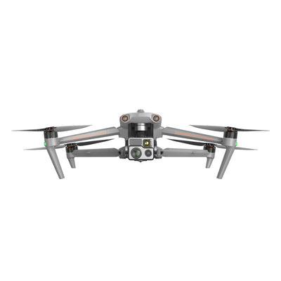
The DJI Mavic 3 Enterprise pairs a 20 MP 4/3 wide camera with a mechanical shutter, RTK readiness, and up to 45 minutes of flight, mapping over 2 square kilometers on a single flight. It is the go-to compact platform for surveyors who want survey-grade accuracy in a drone that fits in a backpack.
DJI Matrice 4E: the flagship mapping platform
The DJI Matrice 4E steps up with a 20 MP 4/3 wide camera, a 48 MP tele, built-in RTK, and up to 49 minutes of flight. For larger corridors and higher-volume mapping, it is the more capable choice.
LiDAR and larger platforms
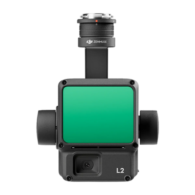
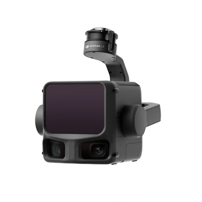
For vegetation penetration and corridor work, LiDAR payloads on Matrice platforms build dense 3D measurements. Browse the RTK and GNSS drones collection and the LiDAR drones collection for the full range.
When you actually need RTK
Reach for RTK when you need measurable, repeatable accuracy: topographic survey, volume calculations, mapping tied to real-world coordinates, and flight lines you want to repeat exactly. For general inspection and visual documentation, standard positioning is often enough. Match the tool to the deliverable rather than paying for accuracy you will not use.
Frequently asked questions
Do I need ground control points if I use RTK?
RTK gives you centimeter accuracy in flight, but a few ground control points are still the best way to check and prove that accuracy on a deliverable. Many survey teams use RTK or PPK for efficiency and keep a handful of control points to validate.
What accuracy can a survey drone achieve?
With RTK and a sound workflow, centimeter-level accuracy is achievable. Actual results depend on your correction source, camera, flight planning, and validation.
RTK or LiDAR for my project?
Photogrammetry with RTK is excellent for open ground and general survey. LiDAR is worth it when you need to penetrate vegetation or capture thin structures. Our mapping guide compares them in detail.
Which DJI drone is best for surveying?
The Mavic 3 Enterprise is the compact, high-value choice, while the Matrice 4E suits larger, higher-volume mapping. The right one depends on your site sizes and deliverables.
Map it once, map it right
The right RTK drone pays for itself in field time saved and rework avoided. Browse the Scanixx RTK and GNSS drone collection with free US shipping on orders over $599, or email info@scanixx.com and we will match a platform and payload to your survey deliverables.