A single pipeline leak in the United States costs an average of $2.8 million in direct cleanup, regulatory fines, lost product, and reputational damage. The inspection programs designed to prevent those leaks have historically relied on helicopter flyovers, ground patrols in trucks, and periodic manned surveys using handheld sensors. These methods work, but they are slow, expensive, and limited by the frequency of inspections they make economically viable.
Drone pipeline inspection changes the economics. A UAV equipped with thermal imaging, RGB cameras, and gas detection sensors covers hundreds of miles of pipeline in hours instead of days, produces georeferenced data that is consistent and repeatable across inspection cycles, and costs 50 to 70 percent less per mile than helicopter surveillance. In 2026, drone-based pipeline inspection is no longer a pilot program for early adopters. It is standard practice for operators who have run the numbers.
At Scanixx, we carry the professional thermal and enterprise drone platforms that pipeline inspection teams use in the field. This guide explains how drone pipeline inspection works, what it finds, which drones are used for which type of survey, and what operators need before their first commercial pipeline job.
What Drone Pipeline Inspection Actually Detects
The value of a drone pipeline inspection program depends entirely on the quality of data it produces. Understanding what each sensor type detects helps operators and asset owners choose the right payload configuration for their specific inspection objectives.
Thermal imaging for leak detection. Liquid leaks and gas leaks both produce temperature anomalies detectable by thermal cameras. A buried pipeline leak creates a surface temperature differential as the product changes the thermal mass of the soil above it. An above-ground leak at a valve, joint, or fitting produces a cold plume for cryogenic products or a heat signature for high-temperature fluids. A 640x512 radiometric thermal sensor on a drone like the DJI Matrice 4T detects these anomalies from an operational altitude of 30 to 80 metres with sensitivity under 30 mK, flagging temperature differences too subtle for human observation at the same altitude.
RGB cameras for corrosion and physical damage. High-resolution optical cameras identify external corrosion, coating failure, mechanical damage, encroachment by vegetation or construction, and third-party interference along the right-of-way. At operational inspection altitudes, a 48MP camera with 56x hybrid zoom allows operators to read pipeline markings, identify specific fitting types, and document the exact location and extent of surface conditions that require maintenance attention.
LiDAR for ground movement and terrain change. Pipelines in areas subject to ground subsidence, slope instability, frost heave, or flooding require periodic terrain surveys to identify movement that could stress the pipe. LiDAR produces dense point cloud data that compares ground elevation across inspection cycles with centimetre accuracy. Areas where the ground has moved relative to previous surveys are flagged automatically, allowing operators to prioritize areas of potential stress concentration before they become integrity threats.
Gas detection sensors for methane and hydrocarbon leaks. Specialist gas sensor payloads mounted on drones detect methane and other hydrocarbons at parts-per-million concentrations from the air. For natural gas transmission and distribution pipelines, airborne gas detection surveys identify leaks that are invisible to thermal cameras and too small to cause ground temperature anomalies. Several regulatory jurisdictions in the US now accept drone-based methane detection data as part of compliance inspection programs.
How a Drone Pipeline Inspection Mission Works
A professional drone pipeline inspection follows a structured workflow that produces repeatable, documentable data suitable for engineering analysis and regulatory reporting.
Route planning. The inspection team imports the pipeline route from GIS data into flight planning software. The software generates an automated flight path that maintains consistent altitude above the pipeline, accounts for terrain variation, and flags airspace restrictions along the corridor. For long-distance inspections covering hundreds of miles, the route is divided into individual mission segments sized to battery endurance.
Mission execution. The drone flies the automated route, capturing thermal, RGB, and supplementary sensor data continuously. The operator monitors the live feed and intervenes manually for any anomaly that warrants closer inspection during the flight. GPS coordinates are embedded in every image and sensor reading, creating a georeferenced dataset where every data point can be located precisely on the pipeline map.
Data processing. Thermal and RGB images are stitched into georeferenced orthomosaics. LiDAR data is processed into point clouds and digital terrain models. Gas sensor readings are mapped against GPS coordinates to produce concentration profiles along the pipeline corridor.
Anomaly classification. The processed dataset is reviewed by inspection engineers who classify detected anomalies by type and severity. Modern inspection platforms increasingly use AI-assisted analysis to flag thermal anomalies, surface defects, and encroachment events automatically, reducing the review time for long corridor datasets significantly.
Reporting and work orders. The inspection report documents every anomaly with GPS location, sensor data, image evidence, and a recommended action. This report goes directly to the maintenance planning team as an actionable document rather than a general health summary.
DJI Matrice 4T: The Multi-Sensor Standard for Pipeline Inspection
The DJI Matrice 4T is the most widely deployed compact thermal drone for pipeline inspection work in 2026. Its four-sensor payload combining a 640x512 radiometric thermal camera, a 48MP wide optical camera, a 56x hybrid zoom tele camera, and a 1,800-metre laser rangefinder provides the full sensor suite needed for a comprehensive above-ground pipeline survey in a single aircraft.
The laser rangefinder is particularly useful for pipeline inspection. When the thermal feed identifies an anomaly, the operator acquires its precise GPS coordinates with a single button press at ranges up to 1,800 metres. Those coordinates are immediately available for the inspection report without manual GPS lookup or coordinate estimation from the map.
- Thermal Sensor: 640x512 radiometric FLIR Boson+, sensitivity under 30 mK
- Optical Cameras: 48MP wide plus 56x hybrid zoom
- Laser Rangefinder: 1,800-metre range, one-tap GPS coordinate acquisition
- Flight Time: up to 42 minutes
- Transmission Range: 20 km via O3 Enterprise, AES-256 encrypted
- Wind Resistance: Level 7, up to 15 m/s
- NDAA Compliant: yes
Shop the DJI Matrice 4T at Scanixx
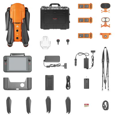
Autel EVO MAX 4T V2: NDAA-Compliant Pipeline Inspection with Radar Obstacle Avoidance
For pipeline inspection contractors working under NDAA compliance requirements, or for operations that run corridor surveys near power lines, vegetation, and structures where radar-based obstacle avoidance is operationally important, the Autel EVO MAX 4T V2 is the leading NDAA-compliant alternative.
The 720-degree obstacle avoidance system combining binocular vision with millimeter-wave radar detects obstacles as small as 0.5 inches and functions reliably in rain, low-light, and dusty conditions where camera-only systems degrade. For pipeline surveys along right-of-way corridors that pass through forested terrain, near transmission lines, or in areas with frequent fog or light rain, the radar layer adds meaningful operational safety margin.
- Thermal Camera: 640x512 radiometric, 16x digital zoom on thermal feed
- Wide Camera: 48MP, ISO up to 64,000 for night operations
- Zoom Camera: 10x optical, 160x maximum hybrid zoom
- Laser Rangefinder: 1.14 km range
- Obstacle Avoidance: 720 degrees, binocular vision plus millimeter-wave radar
- Flight Time: 42 minutes, hot-swappable batteries
- Operating Temperature: minus 20 to 50 degrees Celsius
- NDAA Compliant: yes
Shop the Autel EVO MAX 4T V2 at Scanixx
The ROI Case for Drone Pipeline Inspection in 2026
The cost comparison between drone inspection and helicopter surveillance is well documented across the US oil, gas, and utility sectors.
Helicopter pipeline surveys typically cost between $1,500 and $3,500 per flight hour, with a single inspector covering 50 to 100 miles of pipeline per hour under good conditions. For a 500-mile gathering system inspected twice annually, helicopter costs run between $30,000 and $70,000 per inspection cycle before adding data processing and reporting costs.
A drone inspection team covering the same 500-mile corridor operates at a fraction of that cost. Equipment deployment, pilot costs, data processing, and reporting for a two-person drone inspection crew covering 500 miles typically runs $8,000 to $18,000 depending on terrain complexity and data deliverable requirements. The reduction is 50 to 70 percent per inspection cycle.
The frequency advantage compounds that saving. Because drone inspections cost less per mile, operators can afford to inspect more frequently. A pipeline that received two helicopter surveys per year can receive monthly drone surveys for the same annual budget. More frequent inspection means faster detection of developing anomalies before they become reportable incidents. Industry data consistently shows that moving from annual to quarterly inspection cycles reduces the rate of unexpected pipeline incidents by 30 to 50 percent for the inspected assets.
Regulatory Considerations for Drone Pipeline Inspection
FAA Part 107. All commercial drone operations in the United States require a Part 107 Remote Pilot Certificate. This applies to pipeline inspection drones regardless of the size of the aircraft or the value of the contract.
BVLOS operations. Long-corridor pipeline inspections frequently require flight Beyond Visual Line of Sight. Current FAA regulations require a waiver or authorization for BVLOS operations. The FAA has been expanding BVLOS access through its Beyond program and through specific utility corridor authorizations, but operators planning long-corridor autonomous surveys need to confirm their BVLOS authorization before flying.
Right-of-way airspace. Pipeline corridors frequently pass through controlled airspace near airports and temporary flight restrictions. Pre-mission airspace planning using the FAA's LAANC system handles most routine cases instantly. For complex corridor segments, early coordination with relevant Air Traffic Control facilities is advisable.
NDAA compliance for regulated operators. Utility companies receiving federal infrastructure funding and contractors working on federally funded pipeline programs must use NDAA-compliant equipment. Both the DJI Matrice 4T and Autel EVO MAX 4T V2 meet NDAA requirements.
Frequently Asked Questions About Drone Pipeline Inspection
Can drones detect underground pipeline leaks?
Yes, with limitations. Buried pipeline leaks that reach the surface create soil temperature anomalies detectable by high-sensitivity thermal cameras. Liquid leaks in shallow-buried pipelines are more reliably detected this way than gas leaks, which disperse quickly. Gas leak detection from buried pipelines is most reliable using specialist airborne methane sensor payloads that detect hydrocarbon concentrations at the surface above the leak point. Detection reliability depends on soil type, burial depth, and product temperature differential relative to ambient conditions.
How many miles of pipeline can a drone inspect per day?
A two-drone inspection team with efficient ground support can cover 50 to 150 miles of pipeline per day depending on terrain, vegetation density, and the number of sensor passes required. Automated flight planning and hot-swappable batteries on platforms like the Autel EVO MAX 4T V2 maximise coverage by reducing turnaround time between battery cycles. Complex terrain, tight right-of-way corridors, and multi-sensor pass requirements reduce daily throughput.
What is the difference between aerial pipeline inspection and ground patrol?
Ground patrols cover the right-of-way on foot or by vehicle and rely on visual observation and handheld instruments at close range. They are thorough at the individual point level but slow for covering long distances. Aerial drone inspection covers the full corridor from altitude, producing georeferenced data across the entire survey area in a fraction of the time. Ground patrols are typically used for follow-up investigation of anomalies identified by drone surveys rather than as the primary survey method for long corridors.
Do drone pipeline inspection programs replace human inspectors?
No. Drone inspection programs replace certain types of inspection flights and vehicle patrols, not the engineering analysis and decision-making that follows data collection. A drone produces a dataset. A qualified pipeline integrity engineer interprets that dataset, classifies anomalies, and determines the appropriate response. Drone inspection changes what inspectors do, from physically traveling the corridor to reviewing and analyzing comprehensive aerial data, but does not eliminate the need for professional inspection expertise.
Ready to Build Your Pipeline Inspection Program?
Whether you are a pipeline operator bringing inspection in-house or a contractor building a UAV inspection service, Scanixx carries the professional thermal drone platforms used by inspection teams across the US energy sector. Free shipping on all orders over $599. Contact us at info@scanixx.com to discuss configuration options and compliance requirements for your specific program.