


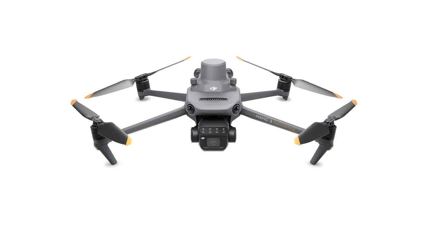
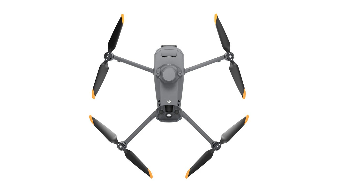
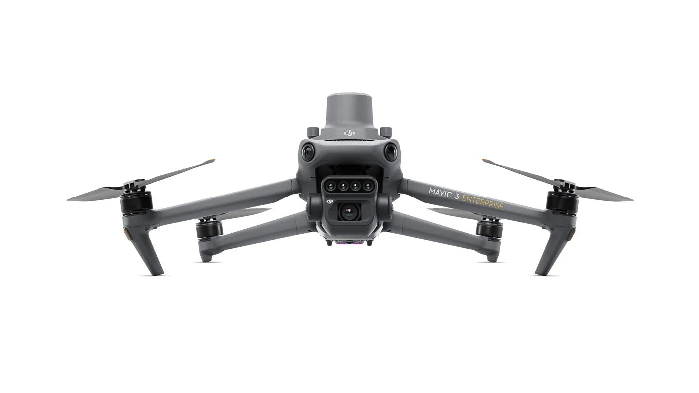
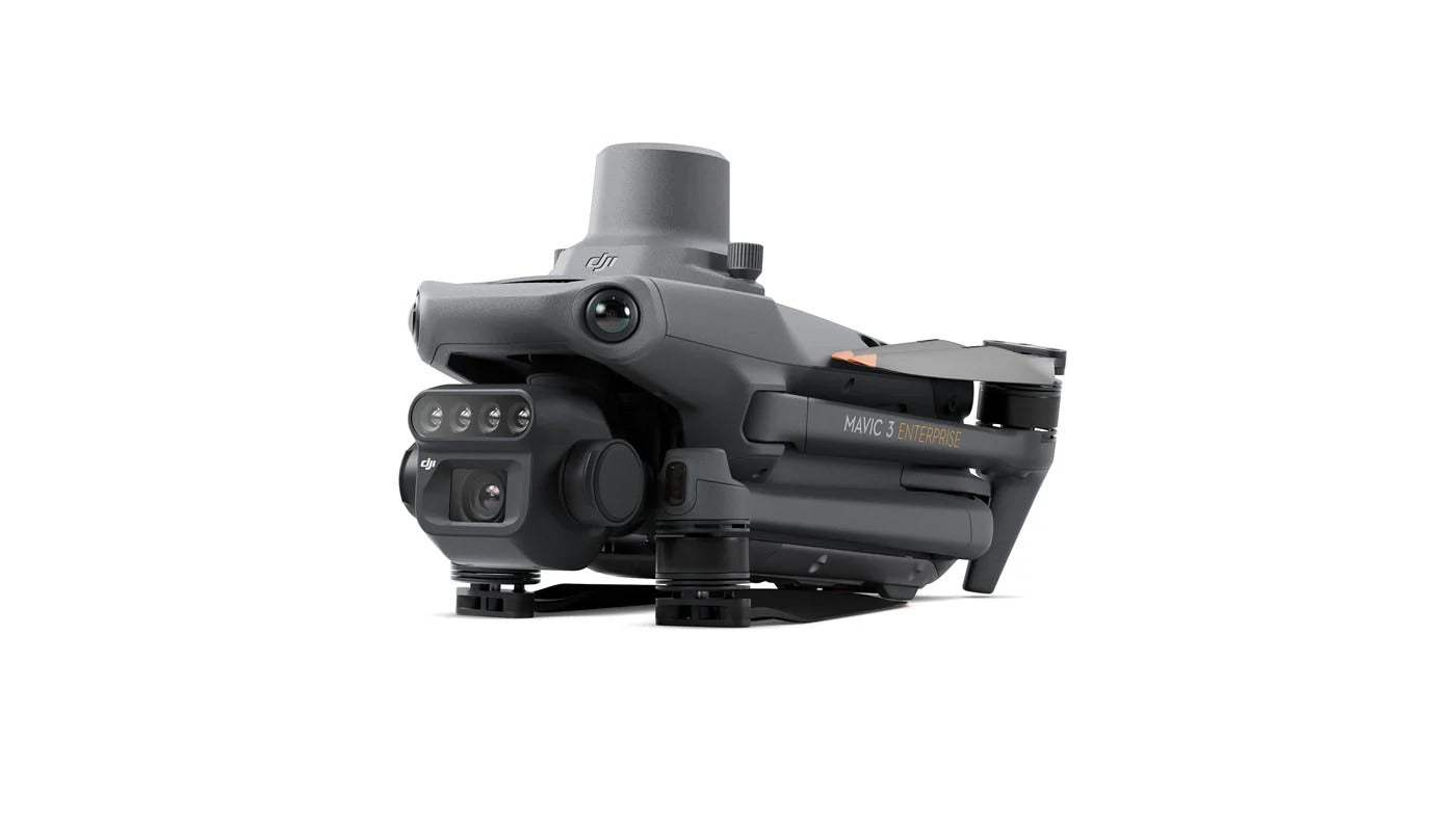
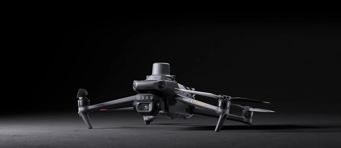
DJI Mavic 3 Multispectral M3M Enterprise Drone
Honestly wasn't sure about dropping 9k on a drone without seeing it first. Emailed them a few questions and got a proper answer back same day, not some copy paste. Pulled the trigger and no regrets.
We were about to order the wrong spreader setup for our acreage. The guy I spoke to actually talked us into a different config that fit better. Saved us a costly mistake. Two units running now.
Drone showed up well packed and the QYSEA works great for our hull checks. Took a bit longer to ship than I hoped but they kept me posted. Had one setup question and they walked me through it on a call.
Bought from a couple other places before and it always felt like ordering off Amazon. These folks actually know the gear. Asked a dumb question about payload compatibility and got a real answer, not a sales pitch.
Had a bunch of technical questions before buying and they came back quick with exactly what I needed. Ordered two units. Setup went fine and when I hit a snag they picked up the phone. Would buy again.
Wanted a saltwater drone that could drop bait at distance. They steered me to the SwellPro and it has held up to a full season offshore. Salt and spray and all. No complaints so far.
First time buying enterprise gear online and I was nervous about it. They sent over a quote with everything itemized, no hidden stuff. Showed up when they said it would. Smooth from start to finish.
Good experience overall. Pricing was fair and the drone is exactly what we needed for tower inspections. Only thing is I wish the lead time was a little shorter, but they were upfront about it so no surprises.
Ordered a thermal unit for search and rescue work with our county. They understood exactly what we were doing and made sure the payload was right before we paid. That kind of attention is rare these days.
Been flying for about eight years and dealt with a lot of vendors. These guys actually pick up the phone and know their stuff. Got the LiDAR setup dialed in for our quarry work. Will be ordering again.
Ordering for a team, fleet, or larger operation?
We work directly with businesses to spec the right systems, negotiate volume pricing, and turn around a tailored quote within 24 hours. No forms. No waiting. Just direct access to people who know this equipment.
Authorized reseller
Authorized reseller
Official authorized reseller. Every product is sourced directly from verified distributors and backed by full manufacturer support.
Full manufacturer warranty
Full manufacturer warranty
All products carry the full manufacturer warranty. Coverage period and terms vary by brand and product — typically 12 months on hardware against defects in materials and workmanship. To claim warranty, contact us directly at info@scanixx.com with your order number and a description of the issue. We handle the process on your behalf.
Expert Support
Expert Support
Our team knows these products inside out. Reach us before or after your purchase for spec advice, compatibility questions, or setup support. We are here to make sure you get the right gear and get it working.
Shipping & Delivery
Shipping & Delivery
We ship via UPS, FedEX,DHL Express. All orders are fully insured in transit. Delivery within 1 to 2 weeks. Live tracking provided on all shipments. Free shipping on orders above $599.
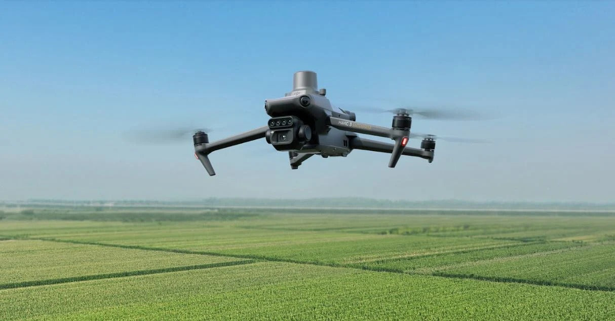
See What Human Eyes Cannot. RGB and 4-Band Multispectral. 43 Minutes. One Flight.
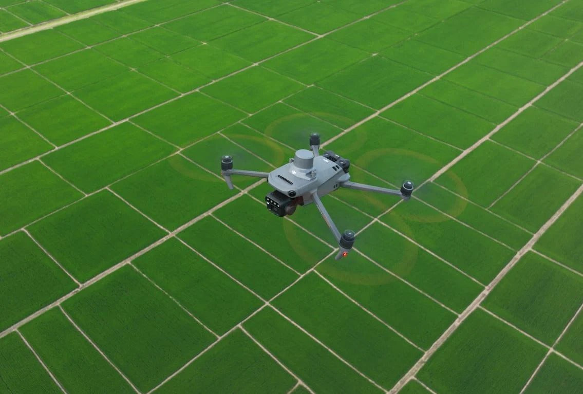
Crop scouting on foot misses the invisible. Nitrogen deficiency, water stress, and early pest pressure are not visible until it is too late. The DJI Mavic 3 Multispectral captures RGB and four-band multispectral data simultaneously, covering up to 500 acres per flight and making crop problems visible before they become yield losses.
- 4/3-inch CMOS 20MP RGB camera plus 4-band multispectral camera. Green (560nm), Red (650nm), Red Edge (730nm), and Near-Infrared (860nm) captured simultaneously with visible imagery. Full NDVI, NDRE, and vegetation health analysis in a single pass.
- 43-minute maximum flight time. Cover nearly 500 acres at standard mapping altitude per battery. Complete large-scale field surveys without multiple batteries mid-operation.
- RTK compatible for centimeter-level accuracy. Precise georeferencing on every multispectral image. Compatible with NTRIP correction services and D-RTK 2 Mobile Station.
- Integrated sunshine sensor. Automatically calibrates multispectral data for changing light conditions throughout the flight. Consistent, reliable reflectance data regardless of cloud cover.
- Terrain-follow aerial surveying for orchards and slopes. Maintains consistent altitude and image scale across irregular terrain without manual altitude adjustment.
- DJI Terra and DJI SmartFarm Platform compatible. Automated orthomosaic generation, NDVI maps, tree counting, and prescription mapping from a single post-processing workflow.
Built for precision agriculture professionals, agronomists, crop consultants, and large-scale farm operators who need actionable vegetation data across hundreds of acres per flight.
Shop the DJI Mavic 3 Multispectral at Scanixx. Free shipping on orders over $599.


